Home / Equipment

Survey Equipment

Survey-grade GNSS, LiDAR, hydrographic and optical instrumentation, owned and operated by our own field teams.

Capability

Instrumentation we field

We do not sub-contract the survey. CDG (Laos) mobilises its own technical survey team and specialised equipment — LiDAR-equipped UAV platforms, single-beam echo sounders, RTK GNSS systems and supporting geodetic instrumentation — for topographic, bathymetric and corridor survey work.

≤5 cm Survey-grade LiDAR accuracy
8 mm RTK horizontal precision + 0.5 ppm
±0.2 mm Digital levelling, 1 km double-run
6,000 m Echo sounder maximum depth range
01 — Positioning

GNSS & RTK positioning

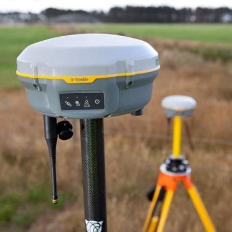
Trimble R8 RTK GNSS receiver on a tripod in the field
USA · 10 sets

Trimble R8 RTK GNSS

  • Horizontal8 mm + 0.5 ppm RMS
  • Vertical15 mm + 0.5 ppm RMS
  • InitialisationTypically < 8 seconds
  • Channels440, Trimble 360 tracking
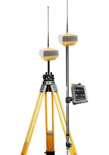
Topcon HiPer XR GNSS receivers mounted on survey tripods
Japan · 6 sets

Topcon HiPer XR Receiver

  • Horizontal5 mm + 0.5 ppm
  • Vertical10 mm + 0.8 ppm
  • TiltRTK tilt compensated
  • ModeNetwork RTK
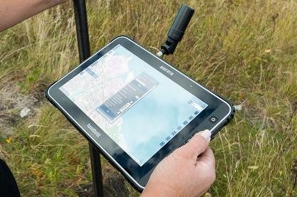
Field surveyor using a rugged RTK data collection tablet
Japan · 6 sets

RTK Field Data Tablet

  • Display7″ sunlight-readable touch
  • ConnectivityBluetooth, Wi-Fi, 4G LTE
  • GNSSCompatible
  • SoftwareMAGNET Field, Top Survey
02 — Airborne

Drone LiDAR & photogrammetry

Fixed-wing and rotary UAV platforms with high-pulse-rate LiDAR sensors and integrated GNSS/IMU positioning, flown with a minimum 60% side-lap for bare-earth extraction under vegetation.
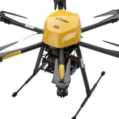
Trimble multirotor drone carrying a LiDAR and photogrammetry payload
USA · 6 sets

Trimble Drone LiDAR / Photogrammetry

High-accuracy LiDAR and photogrammetry mapping with RTK/PPK GNSS, high-density point cloud generation and RGB imagery acquisition.

  • AccuracySurvey-grade, ≤ 5 cm
  • PositioningRTK / PPK GNSS
  • Suited toTopographic, corridor, 3D modelling
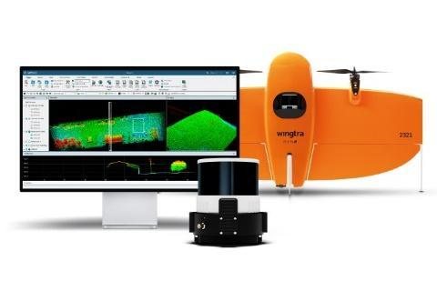
Wingtra VTOL fixed-wing UAV with LiDAR payload and processing workstation
Switzerland · 2 sets

Wingtra VTOL LiDAR

VTOL fixed-wing platform for large-area corridor and topographic mapping, where endurance and coverage per flight matter more than hover time.

  • EnduranceUp to 55 min flight time
  • CoverageUp to 500 ha per flight
  • AccuracyLiDAR ≤ 5 cm
  • PositioningIntegrated PPK / RTK GNSS
03 — Hydrographic

Bathymetric survey

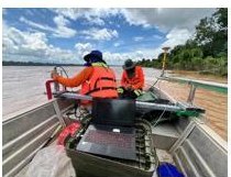
Vessel-mounted hydrographic systems integrating multi-frequency single-beam echo sounders with RTK GNSS positioning, for cross-sections perpendicular to flow direction.

Teledyne Odom Echotrac E20 single-beam echo sounder
USA · 3 sets

Teledyne Odom Echotrac E20

  • Frequency10 kHz – 250 kHz, user-tunable
  • HF channelOptimised 50 – 250 kHz
  • LF channelOptimised 10 – 50 kHz
  • Depth range0.5 m – 6,000 m
Method

Seamless topo-bathymetric surface

Cross-sections run from top-of-bank, through the submerged channel thalweg, to top-of-bank on the opposite side — so the sounding data overlaps the airborne LiDAR and the two merge into one watertight, continuous surface.

  • Cross-sections spaced every 1–2 km and at hydraulic control points
  • Georeferenced profiles in ASCII XYZ and CAD formats
  • River stage correction for water level fluctuation
04 — Ground control

Total stations & levelling

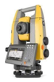
Topcon hybrid robotic total station with integrated GNSS
Japan · 3 sets

Topcon Hybrid Robotic Total Station

  • TypeRobotic, integrated GNSS
  • Prism range4,500 m at 2 mm + 2 ppm
  • Non-prism800 m at 2 mm + 2 ppm
  • MeasurementFine: 0.9 sec
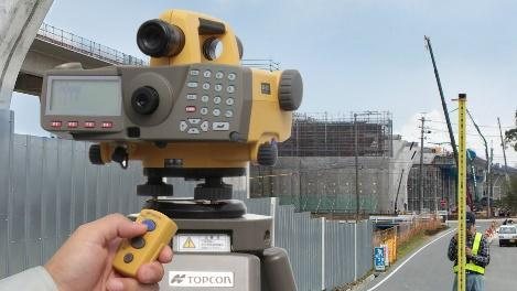
Topcon DL-501 electronic digital level in use on site
Japan · 3 sets

Topcon DL-501 Digital Level

  • Accuracy±0.2 mm, 1 km double-run
  • Magnification32× telescope
  • Range1.6 – 100 m
  • RecordingInternal memory, barcode staff
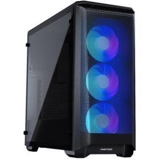
High-specification workstation used for point cloud processing
10 sets + field laptops

Processing Workstations

  • CPUIntel i9-12900K
  • Memory64 GB DDR4
  • StorageNVMe, plus server storage
  • Field32 GB and 16 GB laptops
05 — Software

Processing & analysis stack

Terrasolid

LiDAR point cloud processing and classification for MicroStation.

ArcGIS Pro

Spatial analysis, cartography and data publishing.

Topcon GNSS Suite

Precise survey processing, with levelling processing licences.

Satellite Processing

Static baseline and satellite data processing for control networks.

Need a survey scoped?

Tell us the corridor, the accuracy you need and the deadline — we will size the team and the kit.

Request a survey quote